RegioData
Posta kodu düzeyinde satış fırsatlarını ve riskleri belirleyin. Yedi kilit Avrupa pazarında — dağıtımınızı ölçülebilir hale getirin.
RegioData Set
The RegioData Set is a structured dataset that quantifies regional sales potential for building and renovation products at postal code and district level (NUTS 3) — across 20+ European countries as well as the USA and Canada. You receive the data as an Excel file and process it independently in your CRM, sales planning, or GIS system.
Typical use: You load the file into your system, link the potential values with your sales data per postal code area, and immediately see where your market penetration is high or low. The data forms the basis for territory planning, target agreements, and location assessments.
7 kilit Avrupa pazarında mevcut
Çoğu bölgesel veri sağlayıcısı Almanya ile sınırlıyken, B+L yedi kilit Avrupa pazarı için RegioData hesaplar. Aynı kanıtlanmış metodoloji — her ülkenin kendine özgü veri manzarasına ve dağıtım yapısına uyarlanmıştır.
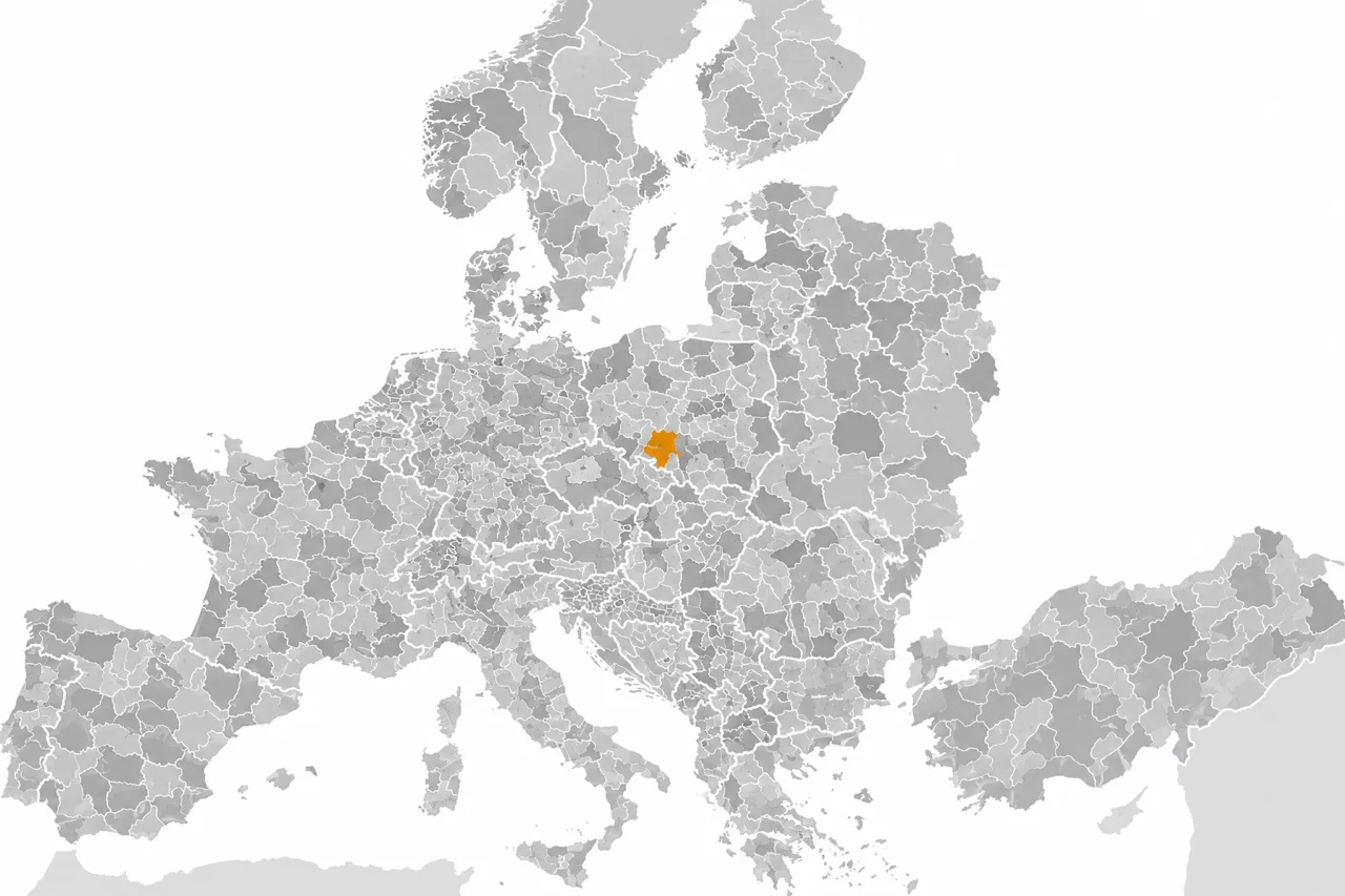
Full coverage from Portugal to Poland and from Norway to Turkey. All major European building materials markets at postal code level.
USA and Canada — at ZIP code and postal code level. The same methodology, adapted to North American market structures.
RegioData ile neler yapabilirsiniz
Belirli ürün kategorileriniz için en yüksek talep potansiyeline sahip posta kodu alanlarını tespit edin. Satış gücünüzü pazarın olduğu yere yoğunlaştırın.
Her bölge, bölge ve satış noktası için gerçek satışlarınızı hesaplanmış pazar potansiyeliyle karşılaştırın. Nerede üstün veya yetersiz performans gösterdiğinizi tam olarak görün.
Tarihsel sınırlar yerine gerçek pazar potansiyeline dayalı olarak satış bölgelerini yeniden tasarlayın. Saha organizasyonunuzda iş yükünü ve fırsatı dengeleyin.
Mevcut ve planlanan depo, showroom veya şube lokasyonlarının potansiyelini çevredeki pazar talebine karşı değerlendirin.
Talebin yoğunlaştığı yere göre teslimat rotalarını ve depo lokasyonlarını optimize edin. Hizmet seviyelerini iyileştirirken maliyetleri azaltın.
Yıllık satış hedeflerinizi geçen yılki rakamlar artı bir yüzdeye değil, gerçek pazar potansiyeline dayandırın. Satış ekibinize inanabilecekleri hedefler verin.
Üç veri seviyesi
RegioData üç dağıtım seviyesinde mevcuttur ve üreticilerin ve toptancıların pazarı kendi özel perspektiflerinden analiz etmelerine olanak tanır.
Dağıtım kanalından bağımsız olarak üretici fiyatlarındaki tüm potansiyeller. Stratejik planlama için tam pazar görünümü.
Yalnızca toptan ticaret yoluyla dağıtılan potansiyeller, ticaret marjları dahil. Toptan kuruluşları için gerçek fırsatı gösterir.
Uzman perakende ve yapı marketleri yoluyla dağıtılan potansiyeller, ticaret marjları dahil. Bölgesel talebe perakende perspektifi.
WBR Endeksi
RegioData'nın merkezinde WBR Endeksi (Wohnen, Bauen, Renovieren — Yaşamak, İnşa Etmek, Yenilemek) bulunur — B+L tarafından 25 yıldan fazla bir süre önce geliştirilen özel bir istatistiksel model. WBR Endeksi posta kodu düzeyinde inşaat ve yenileme ürünleri için göreceli pazar potansiyelini ölçer.
Model inşaat faaliyetini, yenileme oranlarını, gelir seviyelerini, zanaatkâr yoğunluğunu, nüfus yoğunluğunu, tek aile evi payını ve diğer kategoriye özgü faktörleri dikkate alan doğrusal olmayan çoklu regresyon yaklaşımını kullanır. Onlarca yıllık sektör kullanımı ve sürekli kalibrasyon sayesinde, WBR Endeksi inşaat malzemeleri sektöründe bölgesel pazar değerlendirmesi için standart referans haline gelmiştir.
RegioData PotenzialApp
The RegioData PotenzialApp is a web application based on RegioData market potentials, individually configured for each client. Unlike the RegioData Set, which you process yourself, the PotenzialApp provides a ready-made analysis interface in your browser — tailored to your product categories, sales territories, and locations.
B+L sets up the application separately for each client: We configure exactly the product groups, distribution levels, and competitor locations relevant to your business. Your employees or member companies can then independently perform territory analyses without GIS expertise.
Trade associations and purchasing cooperatives offer the PotenzialApp as a service for their member companies. Each location sees its individual market potential, can define catchment areas, and assess its own market penetration against the regional potential.
Manufacturers use the PotenzialApp to identify market potentials at customer locations, evaluate territory overlaps between trade partners, and assess the potential of individual distribution partners on a data-driven basis — without having to operate their own GIS infrastructure.
PotenzialApp features
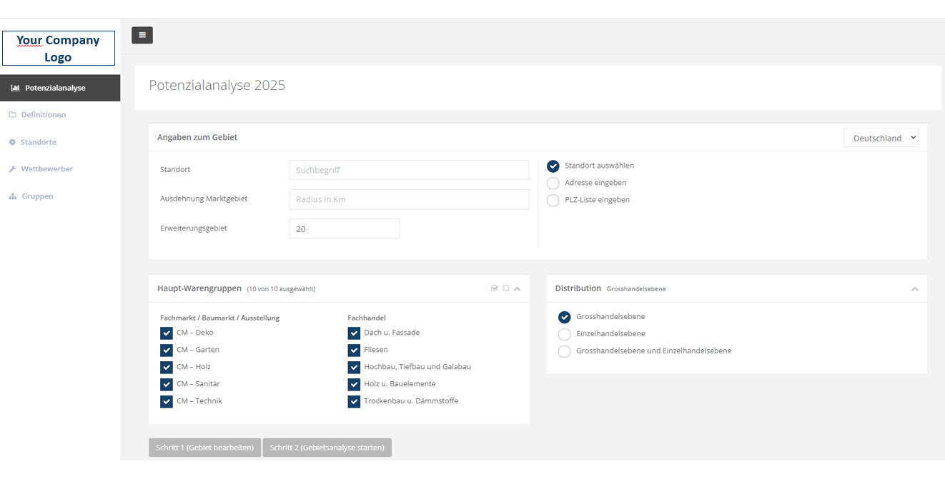
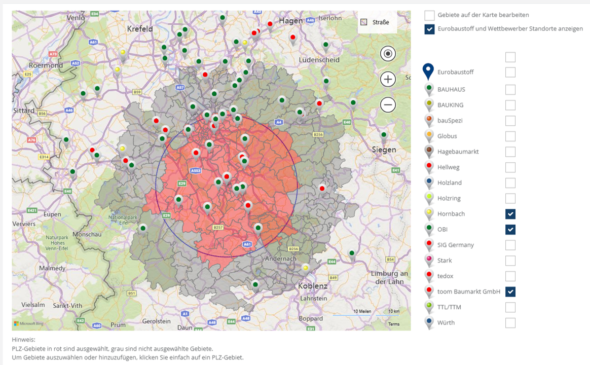
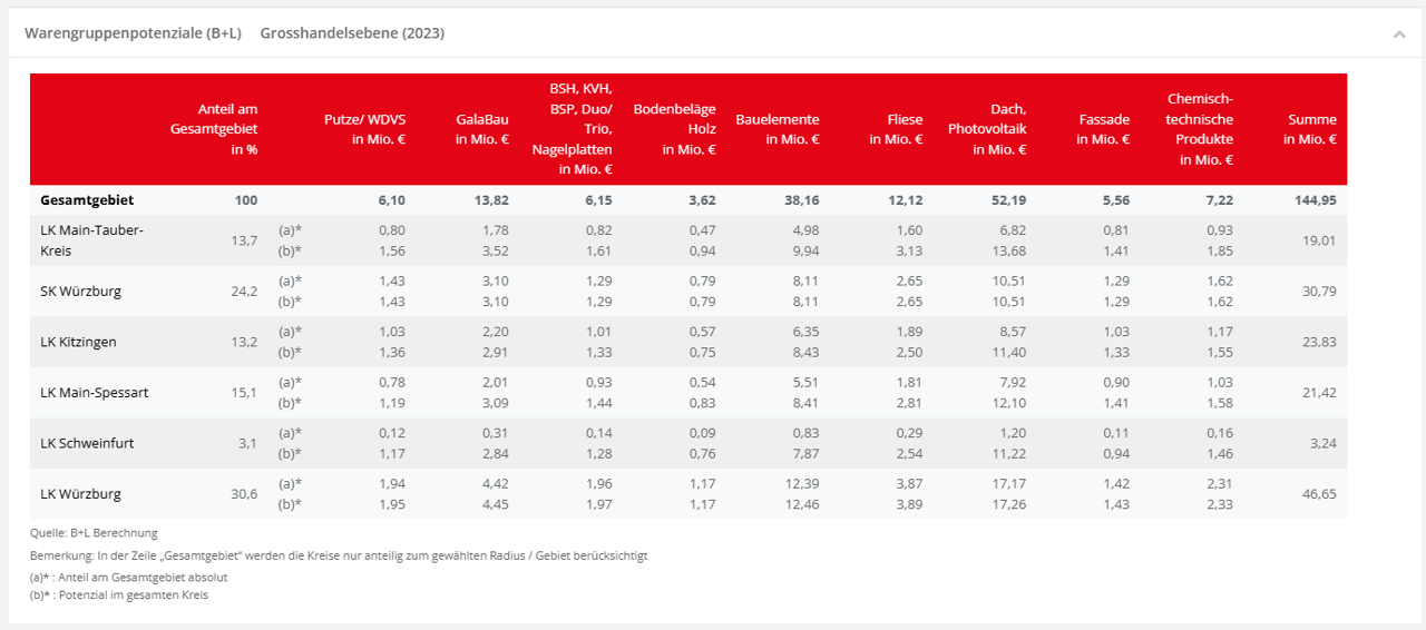
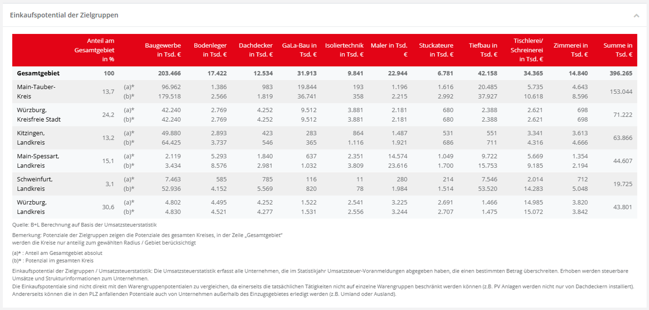
Identify and evaluate overlaps between catchment areas of different locations. Basis for territory optimization and fair target agreements.
Results are calculated in real time and displayed as a territory report — no waiting, no manual data preparation.